Positioning Sensors Used To Navigate On Rough Terrain:
Global Positioning Sensor:
Constructional Working of GPS:
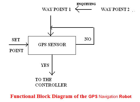
GPS sensor for Navigation Robot is used to navigate the bot reach the fixed destination. Here we use differential gps system, where the carrier frequency is very high even at low signal status certain adaptive methodologies to reach our destination. The functional block shows how the operation is performed by our bot.
Functional Block Diagram of the GPS Navigation Robot:
The block diagram of Final Year Mechanical Project clearly shows the functional working of gps that is here the set point (current position) is compared the first waypoint. Once the destination is reached the program memory enqueue the second way point and so on. If the designated waypoint is not reached again it checks till the destination is reached.
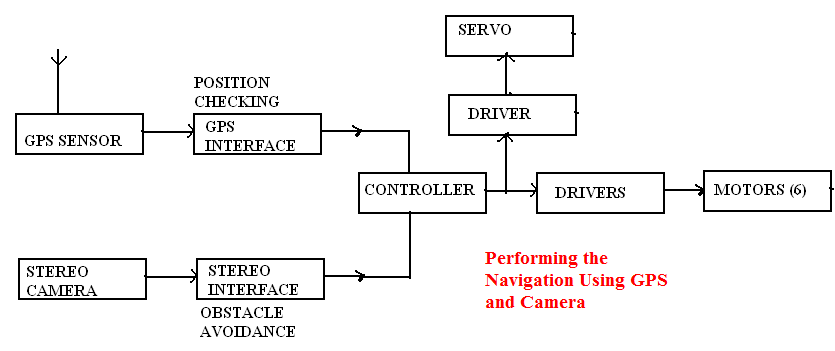
Performing the Navigation Using GPS and Camera:
The effective way of using adaptive robotic technology is performing the complex operation simultaneously to do the desired operation. Similarly we have performed the simultaneous operation by performing both obstacle avoidance and positioning using stereo camera and gps sensor respectively. The main advantage of performing this GPS Navigation Robot operation is maximum nearness error can be avoided that is created during real time positioning. The block diagram clearly shows how the navigation is performed.
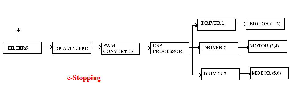
e-Stopping:
we perform the e-stop operation by providing stop signal to the driver .this we attain by converting the availabe frequency (crystal frequency) to PWM signal by using PWM converter .this signal is fed to the motor driver to stop the bot it is be. The block diagam shows the operaton of e-stopping.


