
Project definition:
Purpose behind developing this application in android is that any person who has android OS enabled mobile device can easily see the nearest BRTS bus stop from his/her current location. Users just need this android application installed on their phone. This application will also show the current location. When you click on the application it will open the Google map with showing your current location and view the nearest bus stop from your current location.
This system will be helpful in the following ways:-
- User can easily identify his/her current location from this application
- User will be able to easily find nearest BRTS Bus stop from his/her current location.
- On Selecting get nearest Location Application will draw the path from current location to nearest BRTS locator.
- Application should display the distance between current location to nearest BRT stop.
- User can also see the Next Bus available on Nearest BRTS Stop.
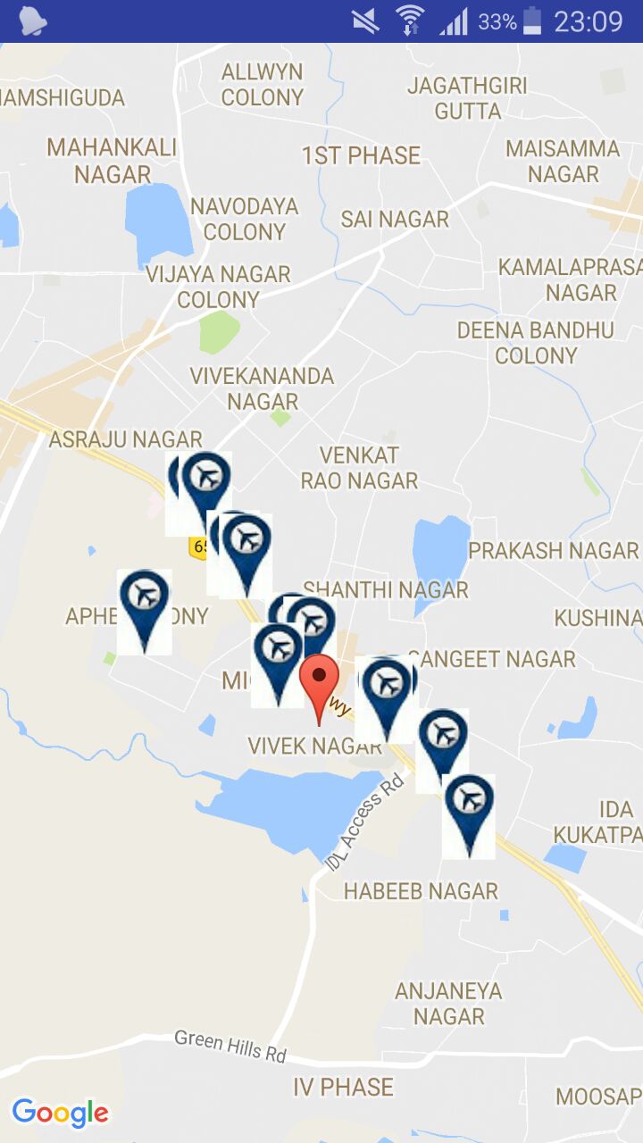
1) Map with name of nearest BRT stop name
- Map with User’s current location
- Map also contain message with following toast:
Nearest BRT stop: ddu
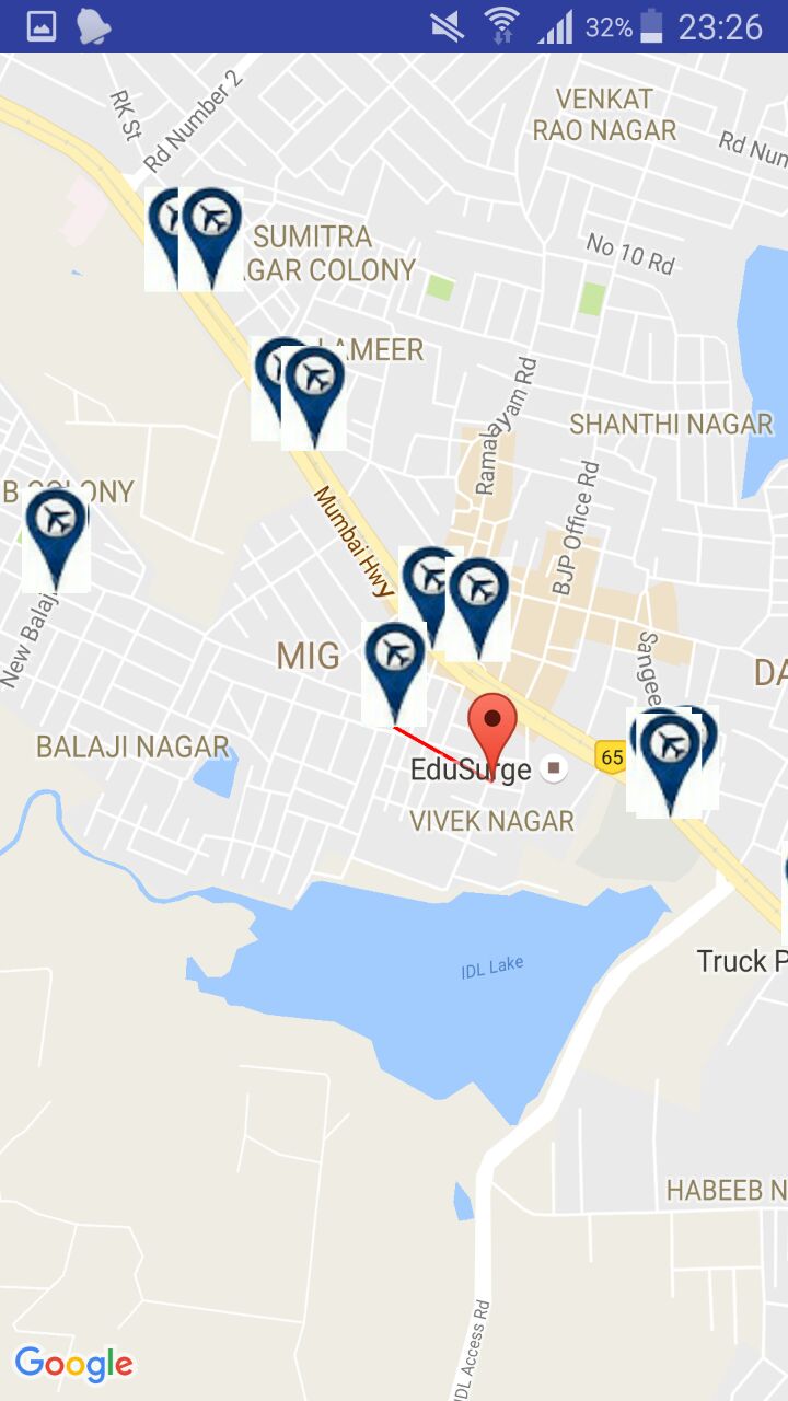
2) Map with distance and drawn path:
On clicking on route & distance button, the application shows the distance and the route to the BRT Stop.
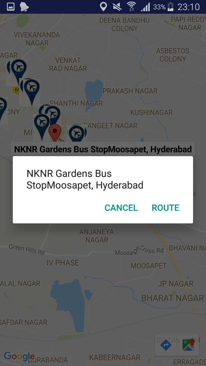
3) Map with next available bus time on particular BRT stop
On clicking on the bus stop flag, the next available bus time will be shown.
What modules have been included in this application?
We have used four modules to design this application. They are as follows:
1) User clicks on Application icon:
When any user clicks on icon of application from phone, users action goes on to application side. And application will be open with map containing the All BRT stop with white balloon icon and users current location with green downward arrow icon.User should wait for map to load completely otherwise sometimes it is possible that users current location might change and show it on different place.
Description: User clicks on Application icon
Input: User clicks on icon
Output: map is loaded with users current location and all BRT stops.
2) User clicks on map to generate menu
When user clicks stickly on map for 3-4 seconds, application will generate a menu that contains the following option:
- Nearest BRT stop
- Distance and Time
- Back
Let’s take a look at each of them.
1) Nearest BRT stop:
When user clicks on first option of the menu then it will display the name of the nearest BRT stop with message (toast in android).
2) Distance and Time:
When user clicks on first option of the menu then it will display the name of the nearest BRT stop with message (toast in android). It will show the message as follows:
3) Back:
When user clicks on back option of menu then application should return in loading state means in state when application loads first time.
3) Application performs operation
When user clicks stickly on map for 3-4 seconds, application will generate a menu that contains the following option:
1) Nearest BRT stop:
When user clicks on first option of the menu then it will display the name of the nearest BRT stop with message (toast in android). It will show the message as follows:
Nearest BRT stop: Kidney Hospital
2) Distance and schedule:
When user clicks on first option of the menu then it will display the name of the nearest BRT stop with message (toast in android). It will show the message as follows:
Distance to Kidney Hospital: 1.2340000km approximate
3) Back:
When user clicks on back option of menu then application should return in loading state means in state when application loads first time.
4) User clicks on map to generate menu
When user clicks stickly on map for 3-4 seconds, application will generate a menu that contains the following option:
- Nearest BRT Stop
- Route & Distance
- Back
Method0logy used in project:
1) Requirement analysis and gathering:
In Requirement analysis and requirement gathering phase we have gather the details about following:
a) Analysis phase:
In analysis phase we had analyze following details:
1) The timing difference between two buses on same station.
2) The amount of time bus stops on each BRT stop.
3) The distance between every two BRT stops.
4) What should be the icon for BRT stop and what should be the icon for user`s current location
b) Requirement gathering phase:
In this phase we have gather the details about following:
1) The longitude and latitude of each BRT stop with its name
2) Create database named location and store longitude and latitude of all BRT stop with their names using SQLite database.
3) Timing of all buses for all BRT stops.
Test Cases, Test Data and Results
| Test Case ID | Description | User i/p | Expected o/p | Actual o/p | status |
| 1 | Check User’s current location | User click on application | application should open with user’s current location and all BRTS bus stops | application open with user’s current location and all BRTS bus stops is shown on map | Pass |
| 2 | Display menu on user action | User clicks on map for 2-3 seconds | a menu with 3 button option should be generated | a menu with 3 button option is generated | Pass |
| 3 | Selection of First Option of Menu to see Nearest BRTS stop from current location | User select or click on the first option of menu for Nearest BRT Stop | Application should generate map with nearest bus stop name from user’s current location | Application generates map with nearest bus stop name and from user’s current location | Pass |
| 4 | Selection of Second option of menu to see path and distance to Nearest BRT Stop from current location | User select or click on second option of menu to see the path and distance | Application should generate path and distance from current location to Nearest BRT Stop. | Application generates path and display distance from current location to nearest BRT Stop. | Pass |
| 5 | User clicks on bus stops icon to check next available bus time. | User click on particular bus stand to see the next available bus time on that stop. | Application should give next available bus time with hours and minute. | Application returns the next available bus time with hours and minute. | Pass |
| 6 | Clicking on third option to go back to map. | User clicks on third option of menu to go back to the map. | Application should return user to the main map that was on loaded first time. | Application returns the user to the main map that was on loaded first time. | Pass |
| 7 | User clicks on back/exit button of device. | User clicks on back/exit button of device. | Device’s current state should be out of application and should be on menus of device. | Device’s current state is out of application and on menus of device. | Pass |
| 8 | Application start but not showing map due to unavailable network | User clicks on Application icon | Application should not display map | Application starts but not showing map | Fail |
User Manual
- Anyone can easily use this Application. It just requires an android device with internet and application installed.
- User can have map on their device now and can view any location by dragging the map.
- When user Click on map for 3-4 seconds it will generate a menu given below. On selecting particular option it will perform specific operation
- User need to touch the map for 2-3 seconds to open dialog for various options. Now, user can select any of the available option in dialog for further operations.
- “Nearest BRT Stop” option will show the nearest BRT Stop name from the current location in the screen.
- “Route and Distance” option will show the path and distance to the nearest BRT Stop from current location.
- “Back” option will get back the earlier map.
- On selecting first option of menu application generate s name of nearest BRT stop with message
- On selecting second option of menu it will generate following results.
- User can click on any of the BRT Stop icon and can view the next available bus time.
- This is the next available bus time from the current location of the user.
- This is the next available bus time from the current location of the user.
Future Enhancement
In Future enhancement we can make the following changes in existing android application.
- The Application can give more available buses with its arrival and departure time.
- The Application can have real-time user location so it can follow user location wherever they go.